High School Track
Overview & Challenge
The High School Track introduces students to artificial intelligence and computer vision by tackling a real-world problem: pothole detection. This beginner-friendly competition emphasizes teamwork, creativity, and hands-on learning. Participants will collaborate in teams to develop AI models that automatically identify and localize potholes in road images, contributing to safer roads and smarter infrastructure.
Teamwork
Form teams of 2-3 students to collaborate, brainstorm, and learn together.
Challenge Summary
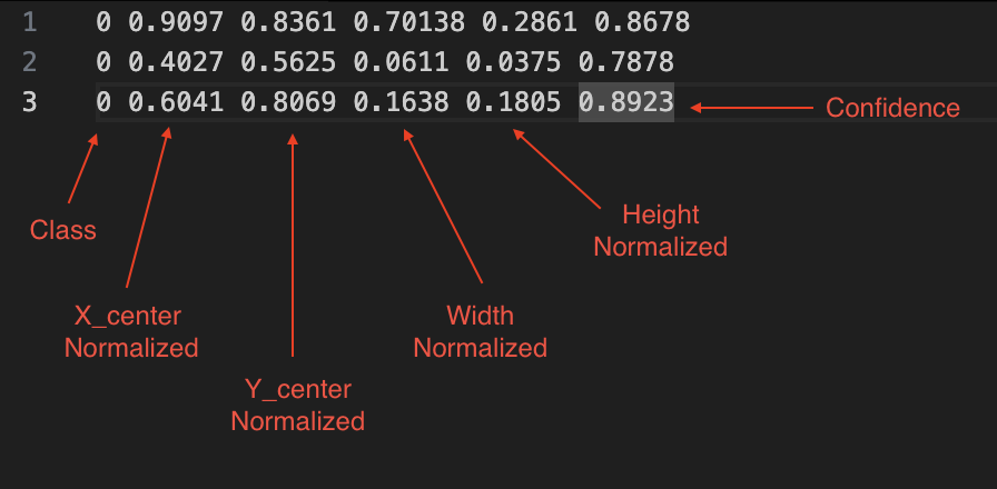
Your mission: Build an Object Detection model that detects and localizes potholes in road images by drawing bounding boxes around each pothole. You will use a curated subset of the Image Dataset—specifically, images from country1 and country2 containing pothole damage.
- Input: Road scene images
- Output: For each pothole, predict its location as a bounding box (class x y w h)
- Focus: Only pothole detection (other damage types excluded for this track)
About the Dataset
The Road Dataset provides thousands of annotated road images from multiple countries. For the High School Track, you will use a simplified subset:
- Countries: country1 and country2
- Damage Type: Pothole
- Annotations: Each image is labeled with bounding boxes around potholes
Training Dataset Distribution
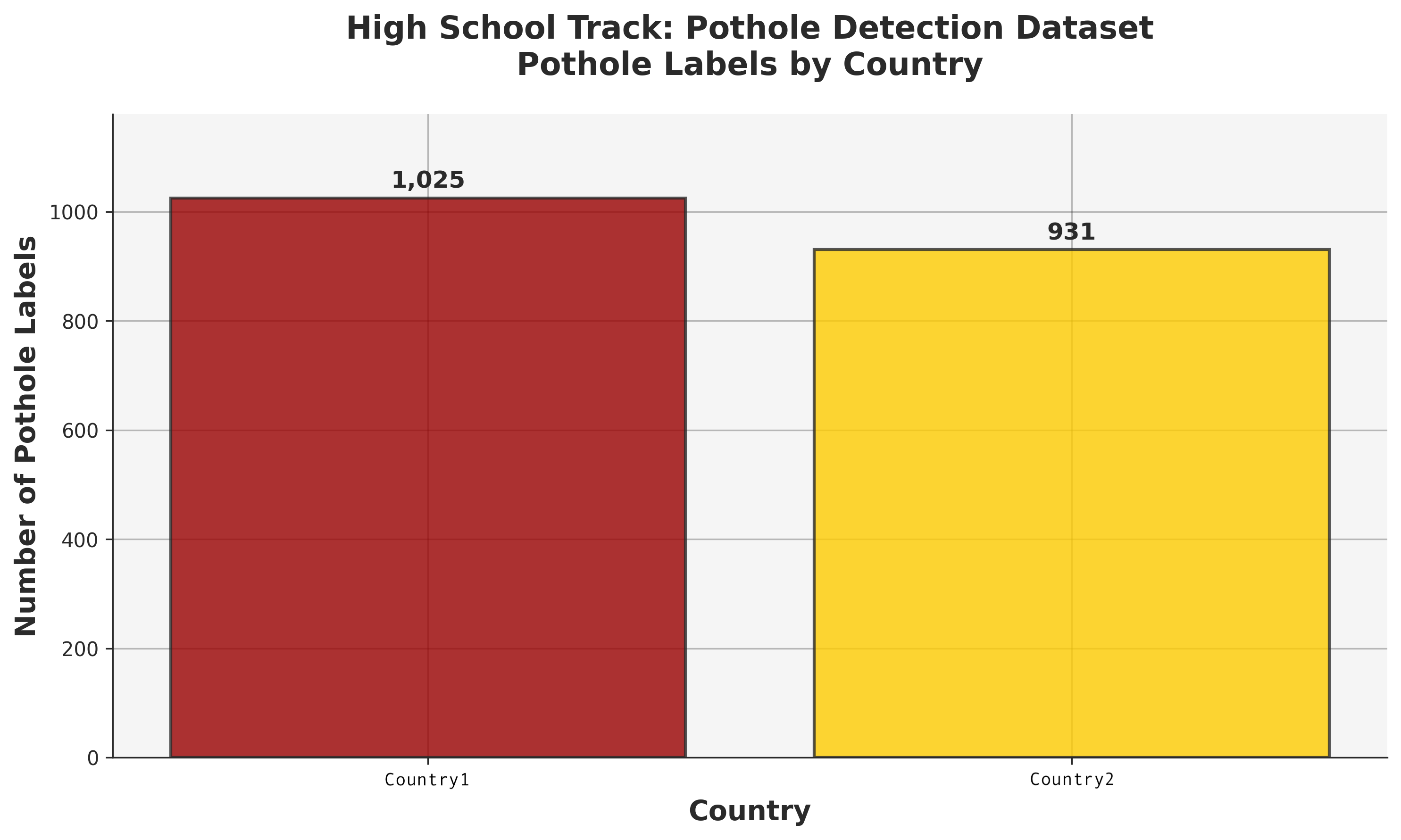
Distribution of pothole labels across countries for the High School Track. Total: 1,956 pothole labels (country1: 1,025, country2: 931)
Training Images by Country
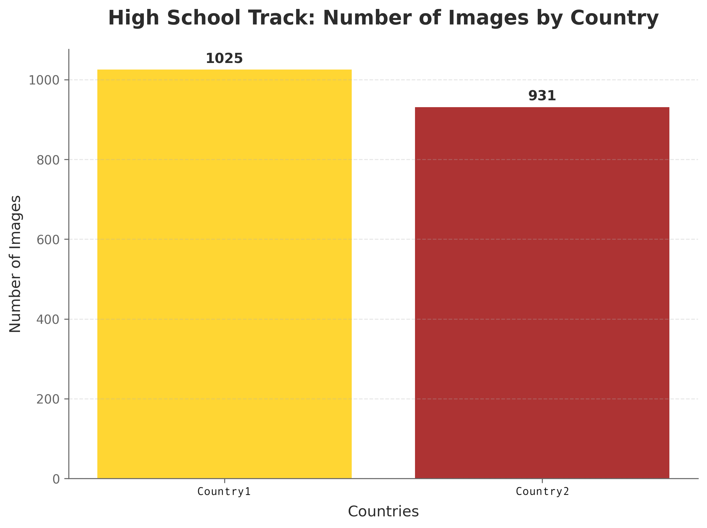
Number of training images available for each country. Total: 1,956 images (country1: 1,025, country2: 931)