College Track
Overview & Challenge
The College Track immerses students in a real-world, industry-inspired challenge: comprehensive road damage detection. Teams will develop advanced AI models to identify and localize four types of road damage—potholes, alligator cracks, longitudinal cracks, and transverse cracks—using a diverse dataset from country1, country2, and country3. This track emphasizes technical depth, teamwork, and professional development, preparing participants for future careers in AI and data science.
Challenge Summary
Your mission: Build an Object Detection model that detects and localizes all four major road damage types in images. For each image, your model should output bounding boxes and class labels for potholes, alligator cracks, longitudinal cracks, and transverse cracks. The challenge uses a subset of the Road Dataset from country1, country2, and country3.
- Input: Road scene images
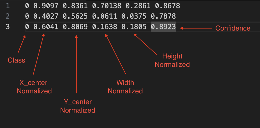
- Output: For each damage, predict its type and bounding box (class x y w h)
- Focus: Multi-class detection and localization
About the Dataset
The Road Dataset for this track includes thousands of annotated images from three countries, with four types of damage labeled:
- Countries: country1, country2, country3
- Damage Types: Pothole, Alligator Crack, Transverse Crack, Longitudinal Crack
- Annotations: Each image is labeled with bounding boxes and damage type
Training Dataset Distribution
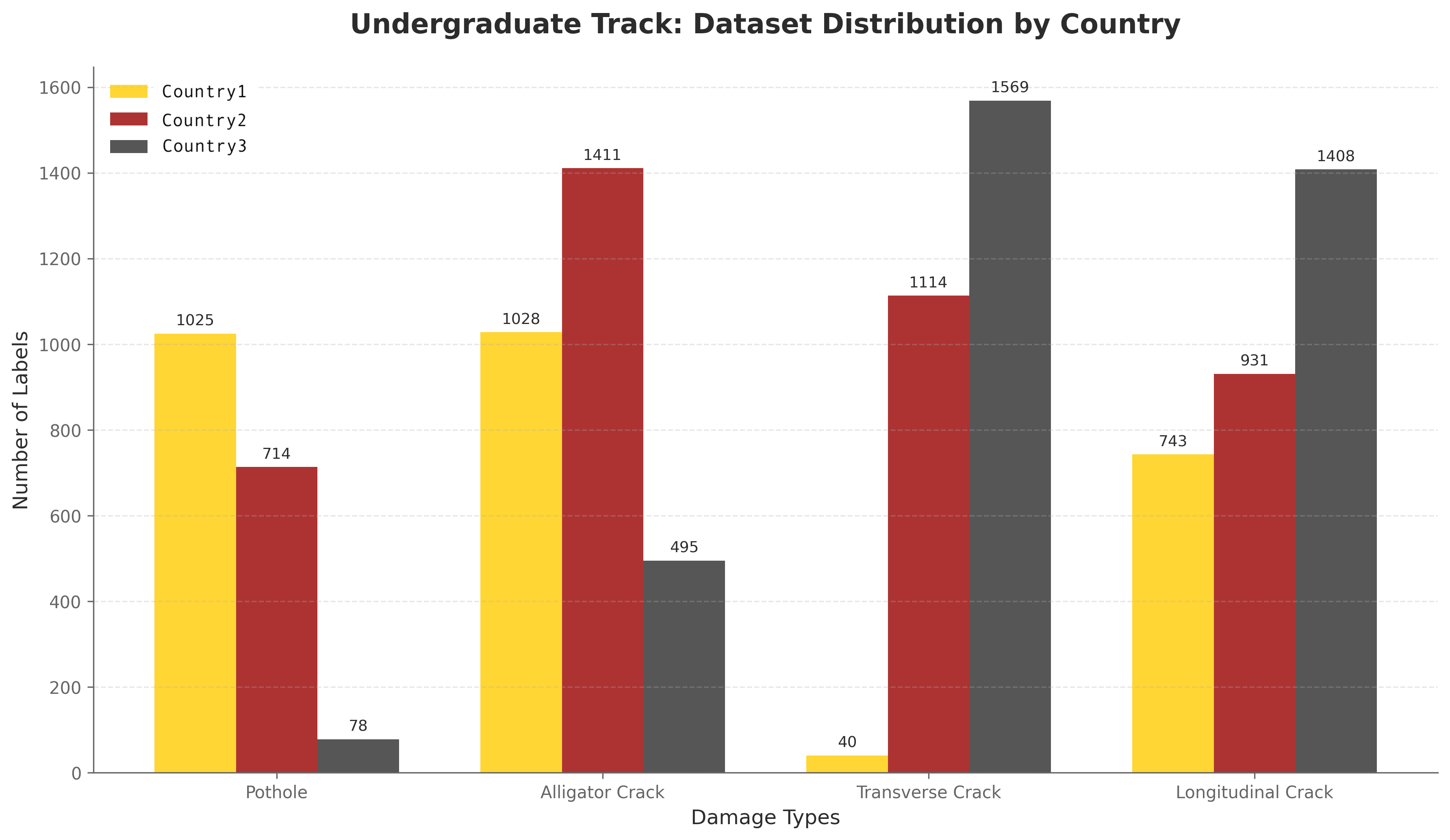
Distribution of damage labels across countries and damage types for the College Track. Total: 10,556 labels across country1 (2,836), country2 (4,170), and country3 (3,550)
Training Images by Country
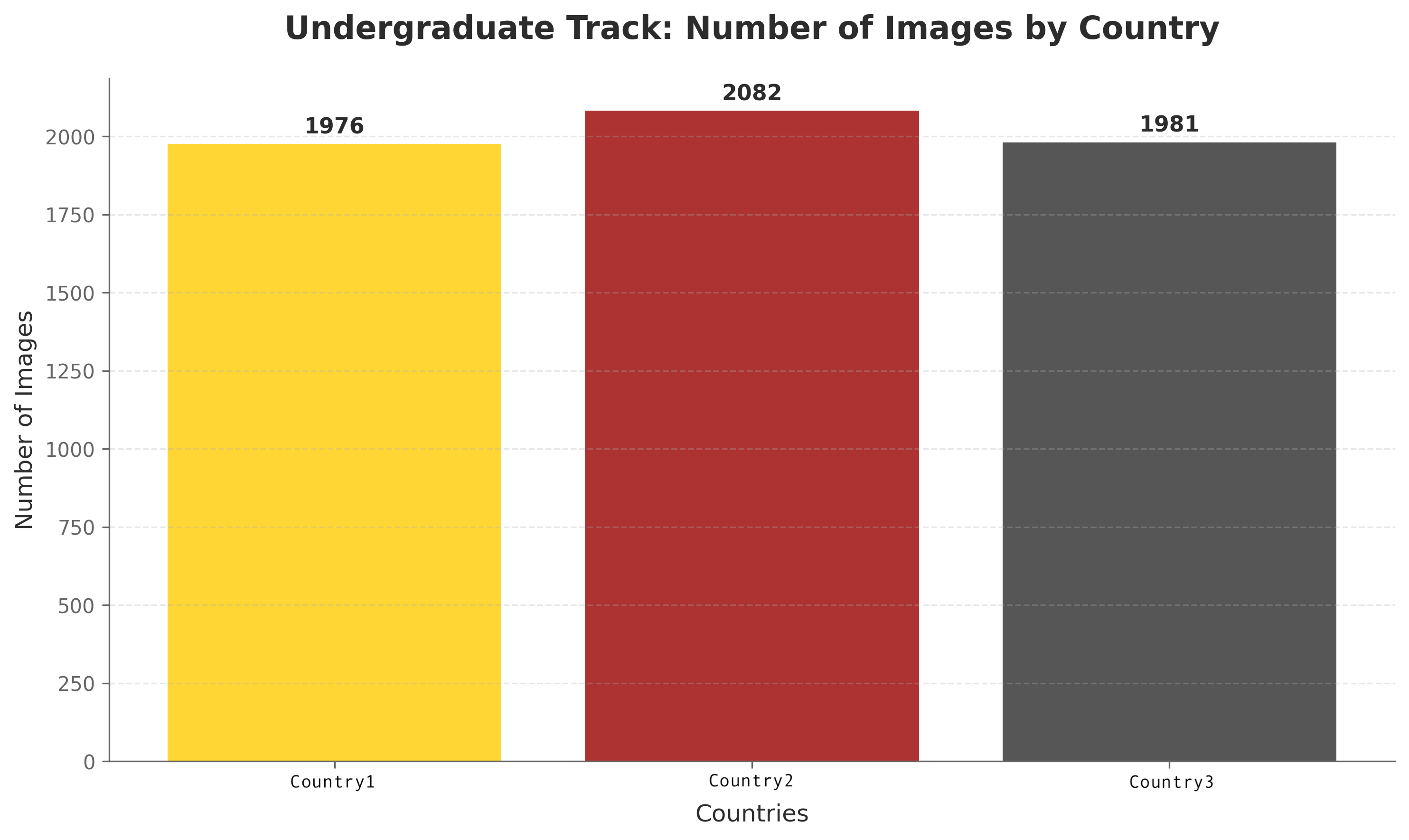
Number of training images available for each country. Total: 6,039 images (country1: 1,976, country2: 2,082, country3: 1,981)